Petroșani (Municipiul Petroşani)
 |
"Pietros" means "stony, rocky" in Romanian. The city of Petroșani was founded in the 17th century (around 1640) with the name Petrozsény. In 1720, an Austrian cartographer mentions that the entire Jiu Valley was intensely populated and settlements could be seen from one end to the other.
During the 1818 census, Petrozsény had 233 inhabitants, while the entire Valley counted 2,550. During this time, the main activity of the people was shepherding and no urban settlement had appeared yet.
Around 1840 coal surface mining began in Petrozsény, Vulkán (today Vulcan) and Petrilla (today Petrila).
Romanian troops attacked the town during the 1916 invasion of Transylvania. A battalion of miners defended Petrozsény in a last stand battle, refusing to give up the town. The Romanian occupation, however, did not last long: the united Austro-Hungarian and German troops liberated the town shortly, in which the guerrilla warfare, led by the local Viktor Maderspach, played an important role.
The town became part of Romania in 1920 as a consequence of the Treaty of Trianon.
The population experienced massive growth only in the 20th century during the communist regime, as many workers were brought in from other parts of the country.
As other cities from the Jiu Valley, throughout the second half of the 19th century and most of the 20th century, most activities in the city revolved around the mines. But after the fall of the communist regime, many mines were closed, and the city, just like the whole valley, was forced to diversify the economy. This has also led to a significant population decline: Petroșani is one of the Romanian cities which has experienced the fastest population loss from the 1990s onwards.
Map - Petroșani (Municipiul Petroşani)
Map
Country - Romania
 |
 |
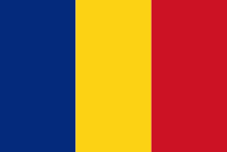
| Flag of Romania | |
Europe's second-longest river, the Danube, rises in Germany's Black Forest and flows southeasterly for 2857 km, before emptying into Romania's Danube Delta. The Carpathian Mountains cross Romania from the north to the southwest and include Moldoveanu Peak, at an altitude of 2544 m.
Currency / Language
| ISO | Currency | Symbol | Significant figures |
|---|---|---|---|
| RON | Romanian leu | lei | 2 |
| ISO | Language |
|---|---|
| HU | Hungarian language |
| RO | Romanian language |


